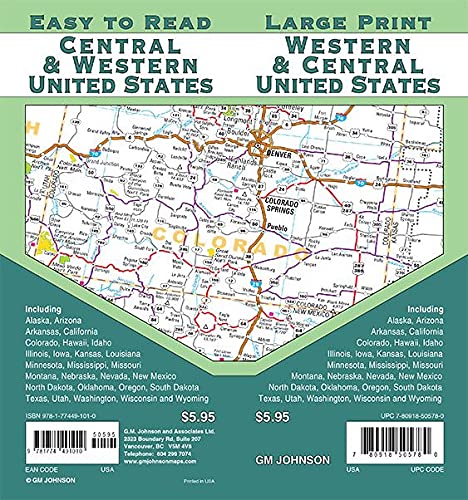


Central & Western United States / Large Print Map
Product Score
See total with duties & tax
Select location for accurate pricing, availability, and delivery estimates
Order today for delivery September 27 - 30
Or by September 26 - 27 with expedited shipping
Delivery by: ![]()
Ships from: Snapklik.com
Warehouse location: New York
In Stock
Cancel for any reason at any time until your order shipped. Once your order has shipped, you may return your order. For details, please review our Returns and Cancellations policies. Special order items may not be eligible for cancellation.
Most items can be returned within 15 days of receipt for a refund of the product cost less return shipping. Shipping, duties, and taxes are not refundable. For details, please review our Returns and Cancellations policies.
Map Coverage Area: Easy to Read Large Print Highway Map of Central & Western United States. Including the states of: Alaska, Arizona, Arkansas, California, Colorado, Hawaii, Idaho, Illinois, Iowa, Kansas, Louisiana, Minnesota, Mississippi, Missouri, Montana, Nebraska, Nevada, New Mexico, North Dakota, Oklahoma, Oregon, South Dakota, Texas, Utah, Washington, Wisconsin, Wyoming and portions of Canada and Mexico.
| Item dimensions | 23 x 11 x 1 cm |
| SKID | 02794777O4542 |
| Manufacturer | GM Johnson |
| Binding | map |
| Number of pages | 2 |
| Publication date | 20210522 |
| EAN | 9781774491010 |