


2025 Large Scale Road Atlas And North Carolina & South Carolina State Maps
See total with duties & tax
Select location for accurate pricing, availability, and delivery estimates
Order today for delivery October 3 - 11
Or by Sep 27 - Oct 7 with expedited shipping
Delivery by: ![]()
Ships from: Snapklik.com
Warehouse location: New York
In Stock
Cancel for any reason at any time until your order shipped. Once your order has shipped, you may return your order. For details, please review our Returns and Cancellations policies. Special order items may not be eligible for cancellation.
Most items can be returned within 15 days of receipt for a refund of the product cost less return shipping. Shipping, duties, and taxes are not refundable. For details, please review our Returns and Cancellations policies.
Product details
- Atlas: A convenient page locator map included on the inside cover makes it quick and easy to find the map you need.
- Folded Maps: Clearly labeled Interstate, U.S., state, and county highways.
- Folded Maps: Indications of parks, points of interest, airports, county boundaries, and more.
- Atlas: Tourism websites and phone numbers for every U.S. state and Canadian province on map pages.
- Folded Maps: Larger map with a bigger type size than the Rand McNally Folded Map.
Beginning with its predecessor, the Auto Chum in 1924, the Rand McNally Road Atlas has been the essential, trusted tool for road travelers for 100 years. This spiral-bound Large Scale edition features all the accuracy you've come to expect from Rand McNally, only bigger. This updated 2024 edition contains maps of every U.S. state, plus expanded coverage of Canada and Mexico, that are 35% larger than the standard atlas version. Also included is more than 350 detailed city inset and national park maps, and a comprehensive, unabridged index. You can find contact information for road construction and conditions conveniently located at the top of each map page.
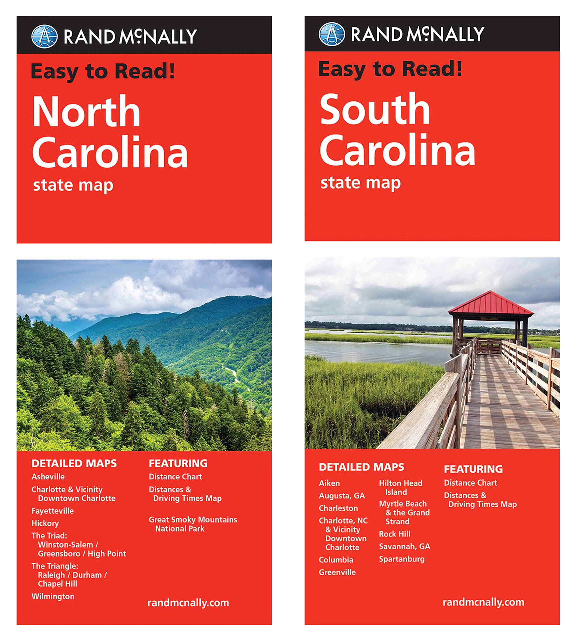
The Road Atlas contains a mileage chart showing distances between 77 North American cities and national parks with a driving times map. Tough spiral binding allows the book to lay open easily. Rand McNally Easy-to-Read State Maps (Folded Road Maps) Rand McNally's Easy-To-Read State Folded Maps are a must-have for anyone traveling in and around these states, offering unbeatable accuracy and reliability at a great price. Their trusted cartography shows all Interstate, U.S., state, and county highways, along with clearly indicated parks, points of interest, airports, county boundaries, and streets.
The easy-to-use legends and detailed indexes make for quick and easy locations of destinations. Rand McNally folded maps have been the trusted standard for years. These items are shipped in a box for protection.
| Item dimensions | 40 x 27 x 3 cm |
| SKID | 091X4PF7P3865 |
| Manufacturer | Rand McNally |