


MapTools Ruler Set For Delorme Atlas & Gazetteer | Texas
Product Score
See total with duties & tax
Select location for accurate pricing, availability, and delivery estimates
Order today for delivery Sep 26 - Oct 4
Or by Sep 25 - Oct 3 with expedited shipping
Delivery by: ![]()
Ships from: Snapklik.com
Warehouse location: New York
In Stock
Cancel for any reason at any time until your order shipped. Once your order has shipped, you may return your order. For details, please review our Returns and Cancellations policies. Special order items may not be eligible for cancellation.
Most items can be returned within 15 days of receipt for a refund of the product cost less return shipping. Shipping, duties, and taxes are not refundable. For details, please review our Returns and Cancellations policies.
Product details
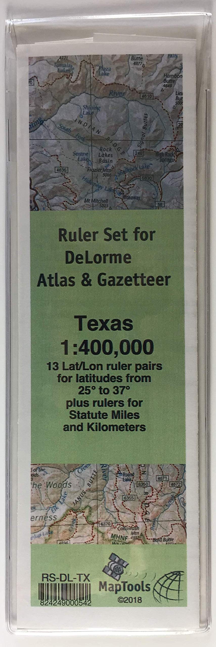
- DeLorme Atlas & Gazetteer - Texas (2017).
- Map Scale: 1:400,000.
- Rulers for measuring miles and kilometers (45 miles, 70km).
- Longitude rulers scaled for latitude in 1 degree increments.
- 13 ruler pairs for measuring latitude longitude (40' 0").
This ruler set was designed to be used with the DeLorme Atlas & Gazetteer for Texas. It contains 13 ruler pairs for measuring latitude longitude coordinates at latitudes ranging from 25° to 37° on a map with a scale of 1:400,000. It also contains rulers for measuring statute miles and kilometers. The pages of the atlas have a printed lat/lon grid shown with thin black lines. The lines are marked with their values just outside of the edges of the map, in a degrees, minutes and seconds format and in decimal degrees. Longitude rulers used north of their design parallel of latitude, will be too long to fit the grid.
The ruler should be "close enough" up to about 1° north of the design latitude. As you move north, you may find the next ruler in the set is a closer fit. You can also use the ruler on a slight diagonal between the grid lines to compensate for the extra length. These rulers are printed on a 10 mil. waterproof polyester stock. They come packaged in a vinyl pouch with an instruction sheet printed on Rite-In-The-Rain paper.
| Item weight | 0.0 kg |
| Item dimensions | 22 x 8 x 1 cm |
| SKID | 02LU4P87YJDZ5 |
| Manufacturer | MapTools |
| Part number | RS-DL-TX |
| UPC | 824249000542 |